Waterways Management - Central region
Navigation data for major rivers and other waterways for the central region.
For all matters related to shoals in the waterways: DFO.WaterwaysManagement-GestionVoiesNavigables.MPO@dfo-mpo.gc.ca
For all matters related to the Water Level Forecasts Bulletin issued by the program: MPO.GCC.NiveauxEauSL-CCG.WaterLevelSL.DFO@dfo-mpo.gc.ca
In the event of a disparity between the content of the interactive versions and the PDF versions, the latter take precedence.
Most requested
Regional Services and Information
St. Lawrence Waterways
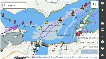
ServiceSt. Lawrence Waterways dynamic cartographic interface.
Great Lakes Waterways
ServiceGreat Lakes, St. Mary's River, St. Clair River and Detroit River Waterways dynamic cartographic.
VN301 - Directives for the Transit of Vessels
ServiceDirectives for the transit of large scale and large length vessels in the St-Lawrence Waterway.
Under-Keel Clearance Table (UKC)
InformationFor Container Ships and Other Ships. (St. Lawrence River, Québec to Montréal)
Shoals in the Waterways
ServiceSt. Lawrence River, St. Mary's River, St. Clair River and Detroit River.
Water Level Forecasts - St. Lawrence Ship Channel
ServiceWater level forecasts and observations, including temperatures, tide and current tables for the central region.
Features
Report a problem on this page
- Date modified:


