Section 5. Applications
Section 5.1. Physical AIS AtoN
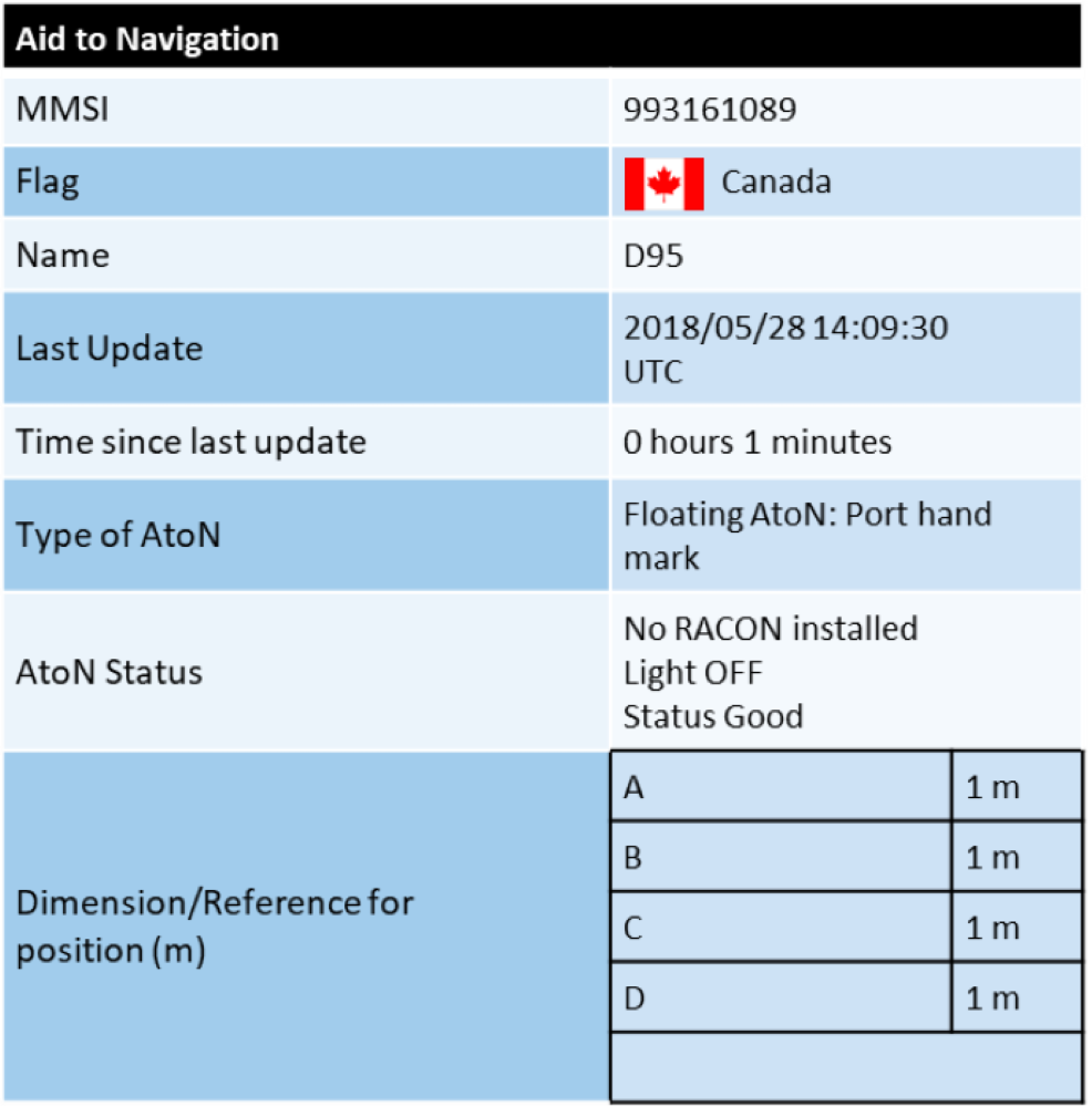
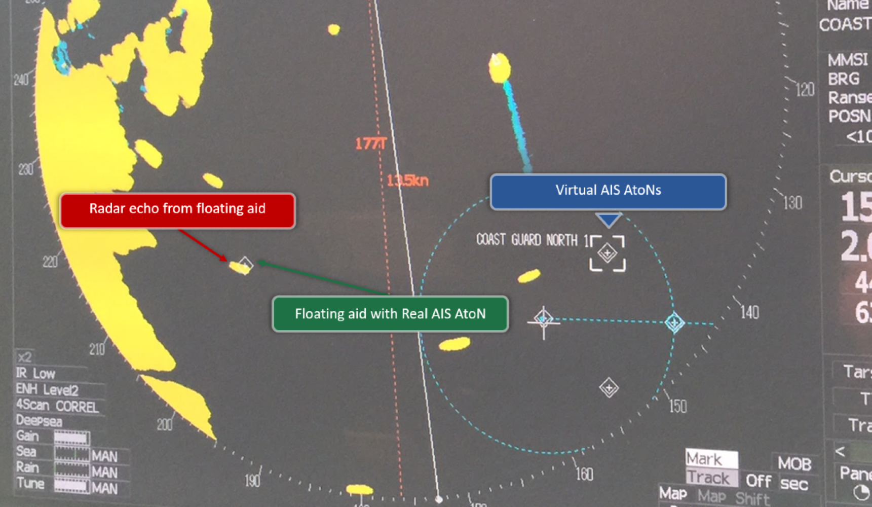
One of the main benefits of Physical AIS AtoN is the broadcast of the floating aid’s position in real time. Depending on the length of the chain used to anchor it, the magnitude of the tides and the water levels, a floating aid to navigation can move several metres from its charted position, leading mariners to assume it is off position. However, and as illustrated by the black circle in Figure 5-2, the position assigned to a floating aid to navigation may cover a large area. The aid is considered within its assigned tolerance radius as long as it remains within a certain distance of its charted position. If this tolerance is exceeded over a certain period of time, the Physical AIS AtoN will broadcast an “Off Position” message (see Figure 5-3). The “Off Position” message will stop if the aid returns to its assigned location circle.
The “Off Position” function is useful for both mariners and the authorities in charge, as it provides remote access to this information, allowing appropriate action to be taken.


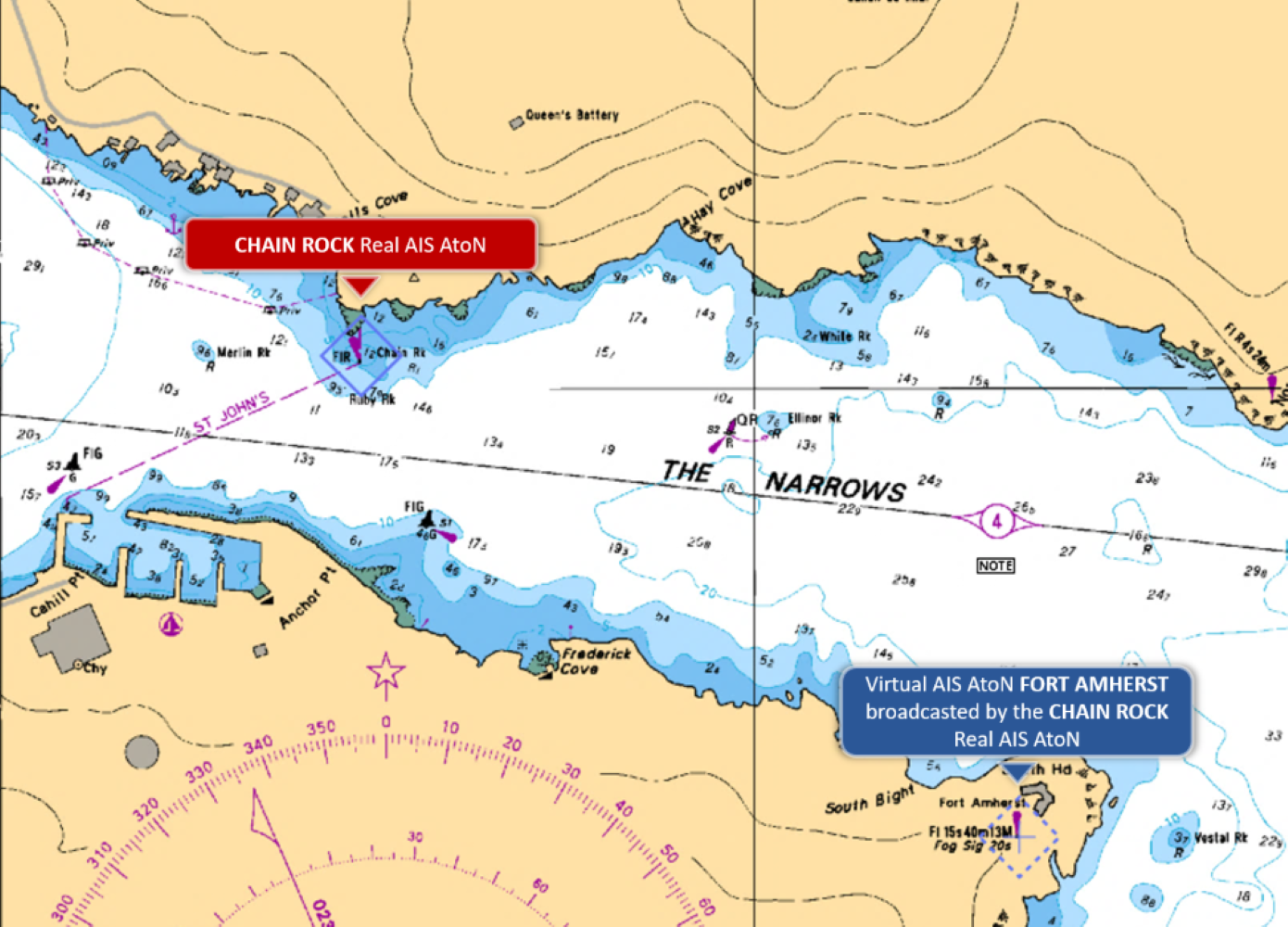
A Physical AIS AtoN may be used to broadcast one or more virtual or Predicted Synthetic AIS AtoN.
Section 5.2. Virtual and Synthetic AIS AtoN
Virtual AIS AtoN can be deployed quickly, and the accuracy of their positions allows them to be used in various situations for the benefit of mariners.
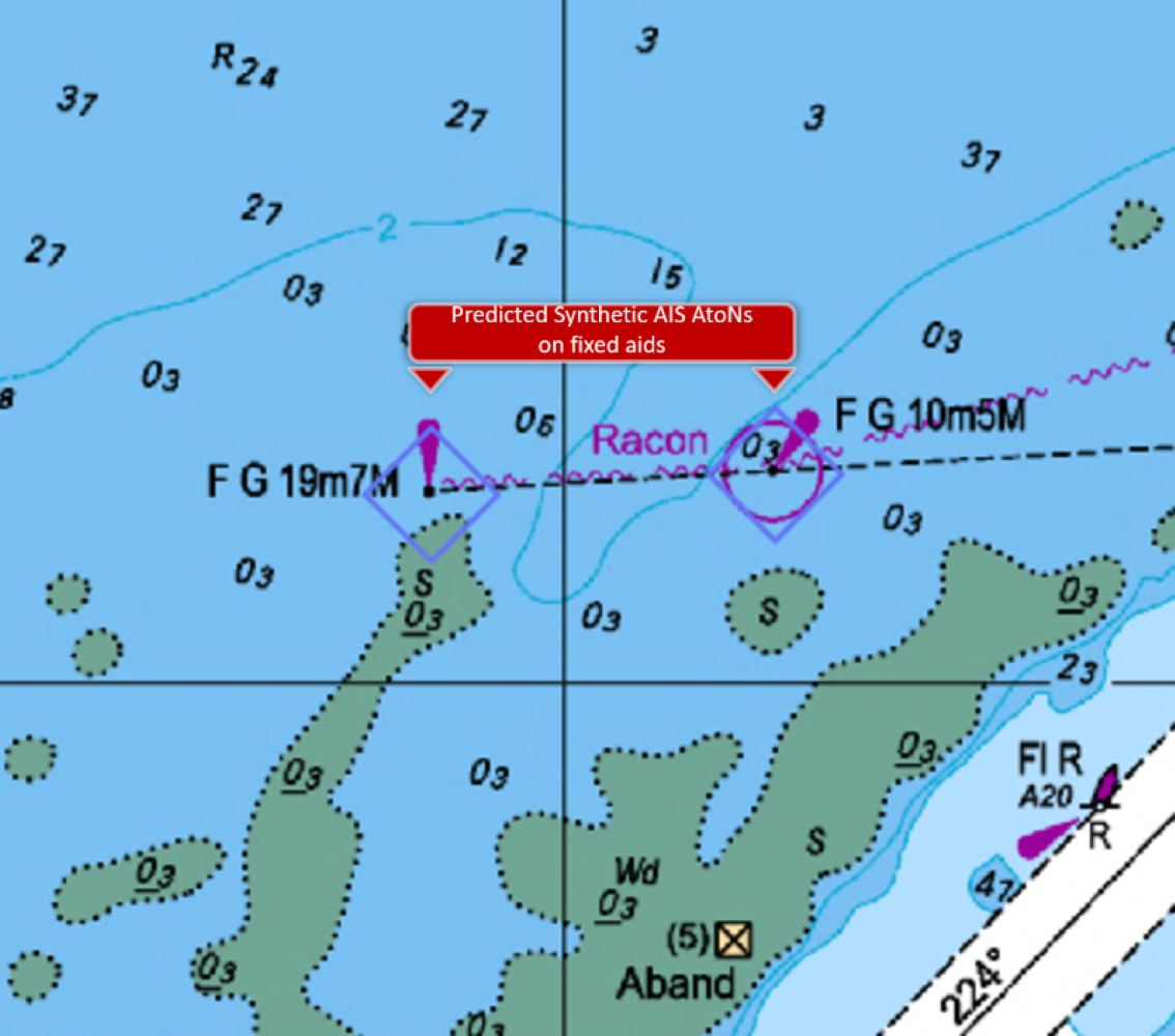
The Canadian Coast Guard is not currently using Monitored Synthetic AIS AtoN. However, Predicted Synthetic AIS AtoN may be used across Canada. These are broadcast on fixed AtoN and help to locate them, even in situations where the radar screen is cluttered.
Section 5.2.1. Reference Points - Virtual and Synthetic AIS AtoN
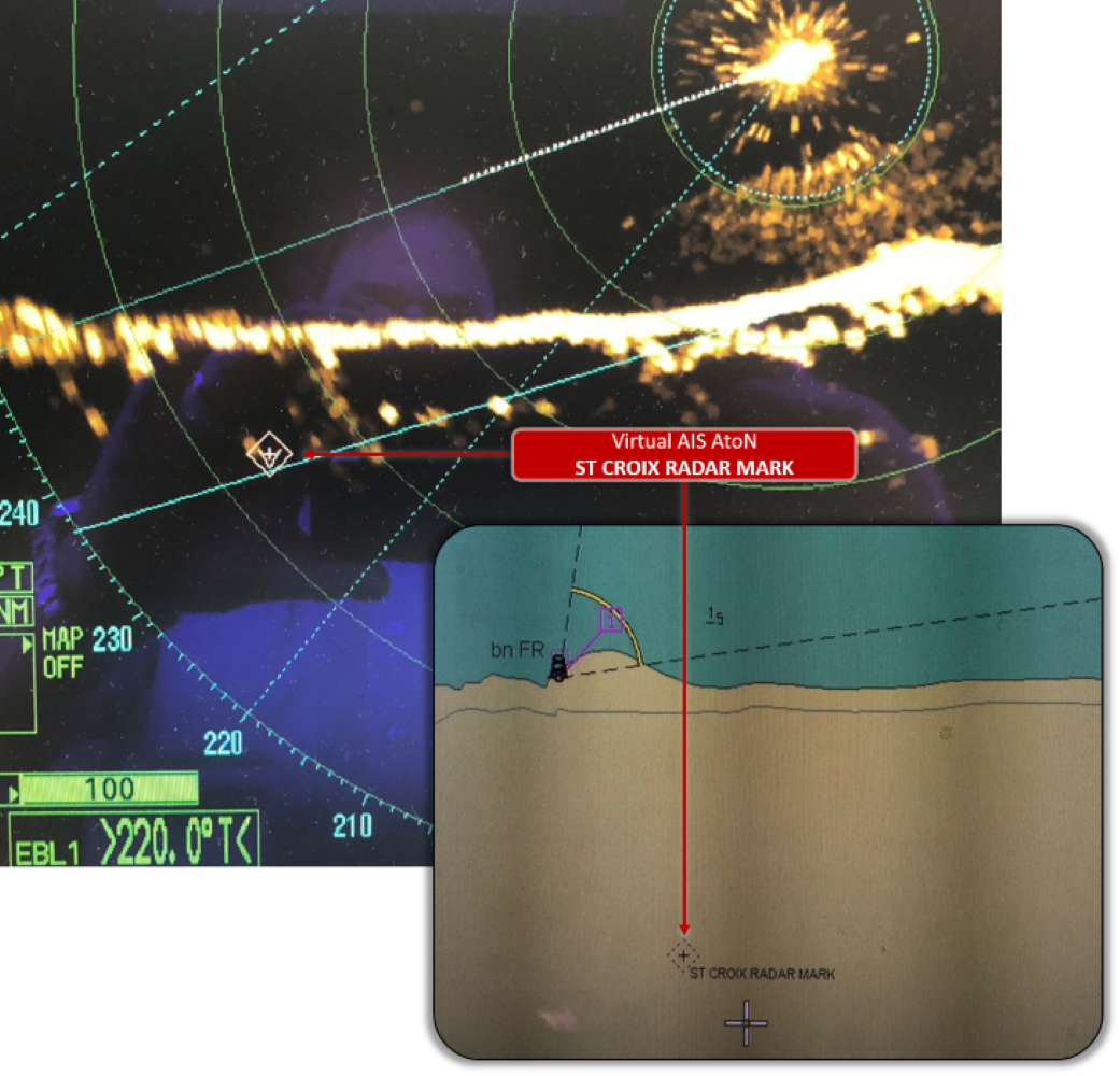
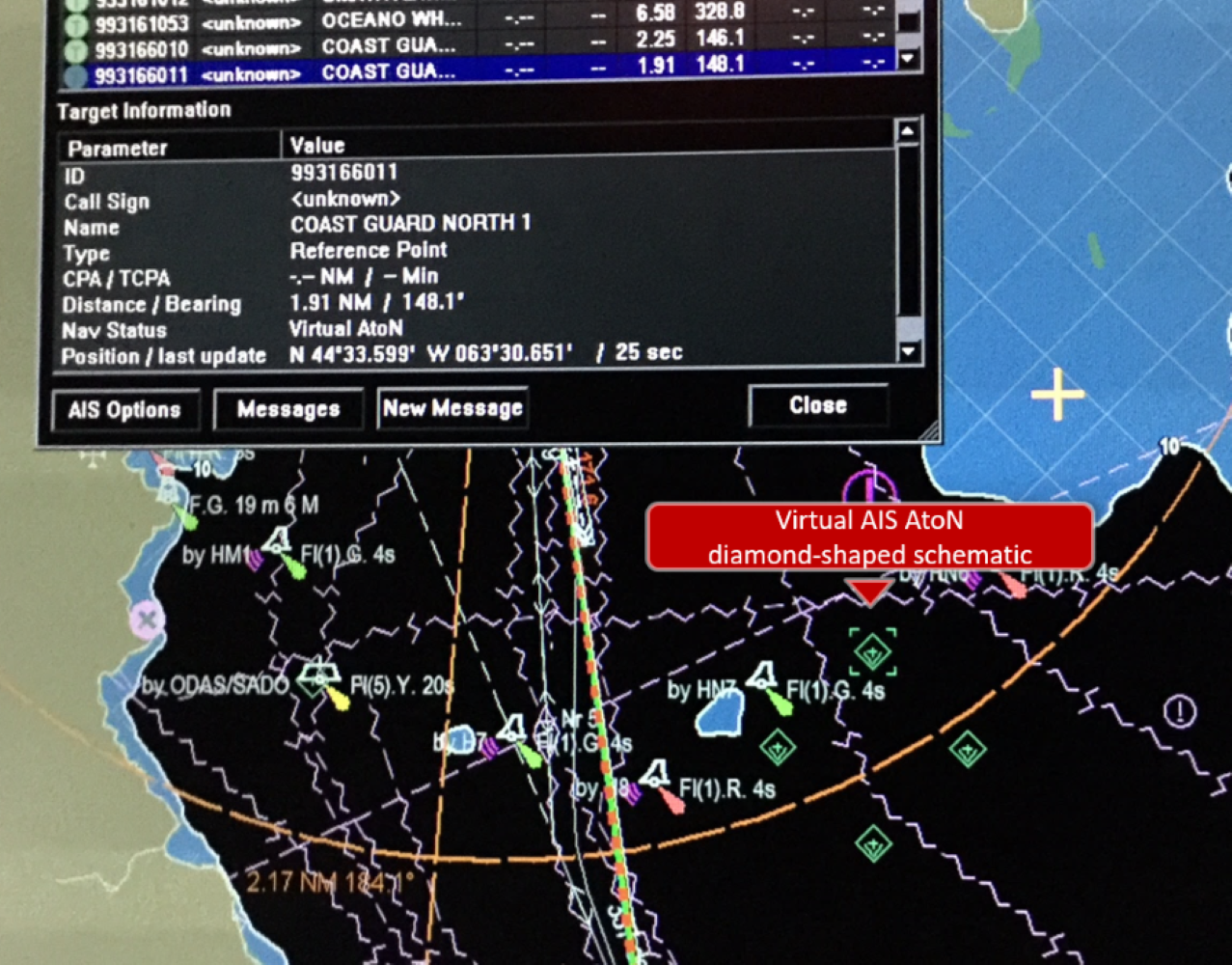
The diamond shape is displayed on ECDIS as well as on radars. On-board instruments make it possible to check whether the displayed information is identical to that shown on the schematic.

This example demonstrates that the use of Virtual AIS AtoN alone does not detect a radar positioning error, as no echo is reflected by the virtual AtoN (see Figure 5-8).
Section 5.2.2. Identification of Radar Marks
At Lac Saint-Louis (in the St. Lawrence Seaway, Figure 5-11), Synthetic AIS AtoN are broadcast on the front and rear ranges in the Kahnawake area. Figure 5-13 illustrates the benefit of using the Predicted Synthetic AIS AtoN to help locate fixed AtoN on the radar. The photo was taken in December 2017 as the ice cover began to form. The AIS AtoN symbols help to rapidly locate the position of fixed AtoN on the radar screen cluttered with ice echoes.
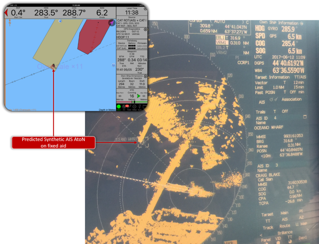
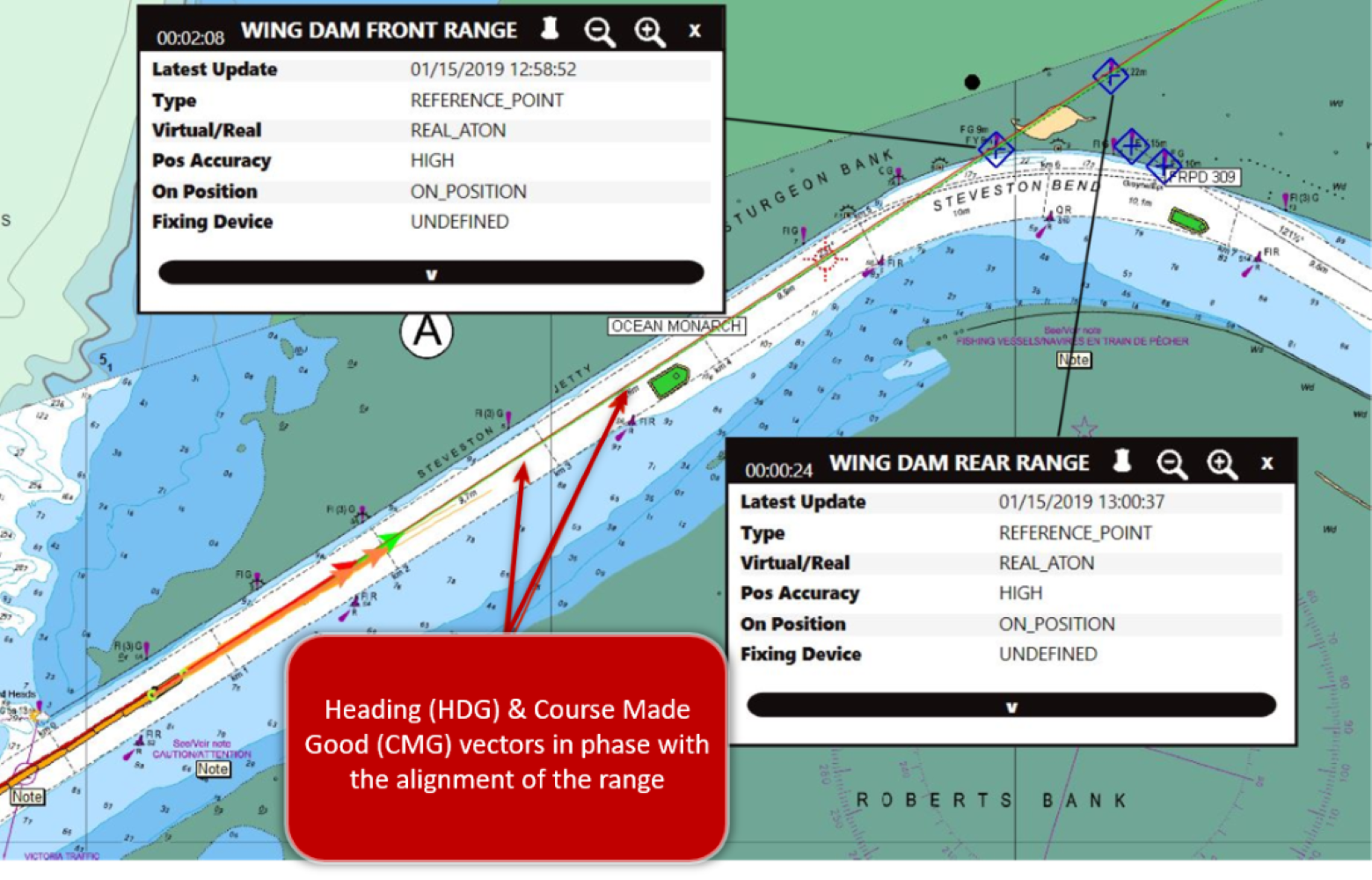
Similarly, on the Fraser River in British Columbia, pilots have observed the added value of the Predicted Synthetic AIS AtoN for gyro error detection and validation of the course made good. (Figure 5-13).
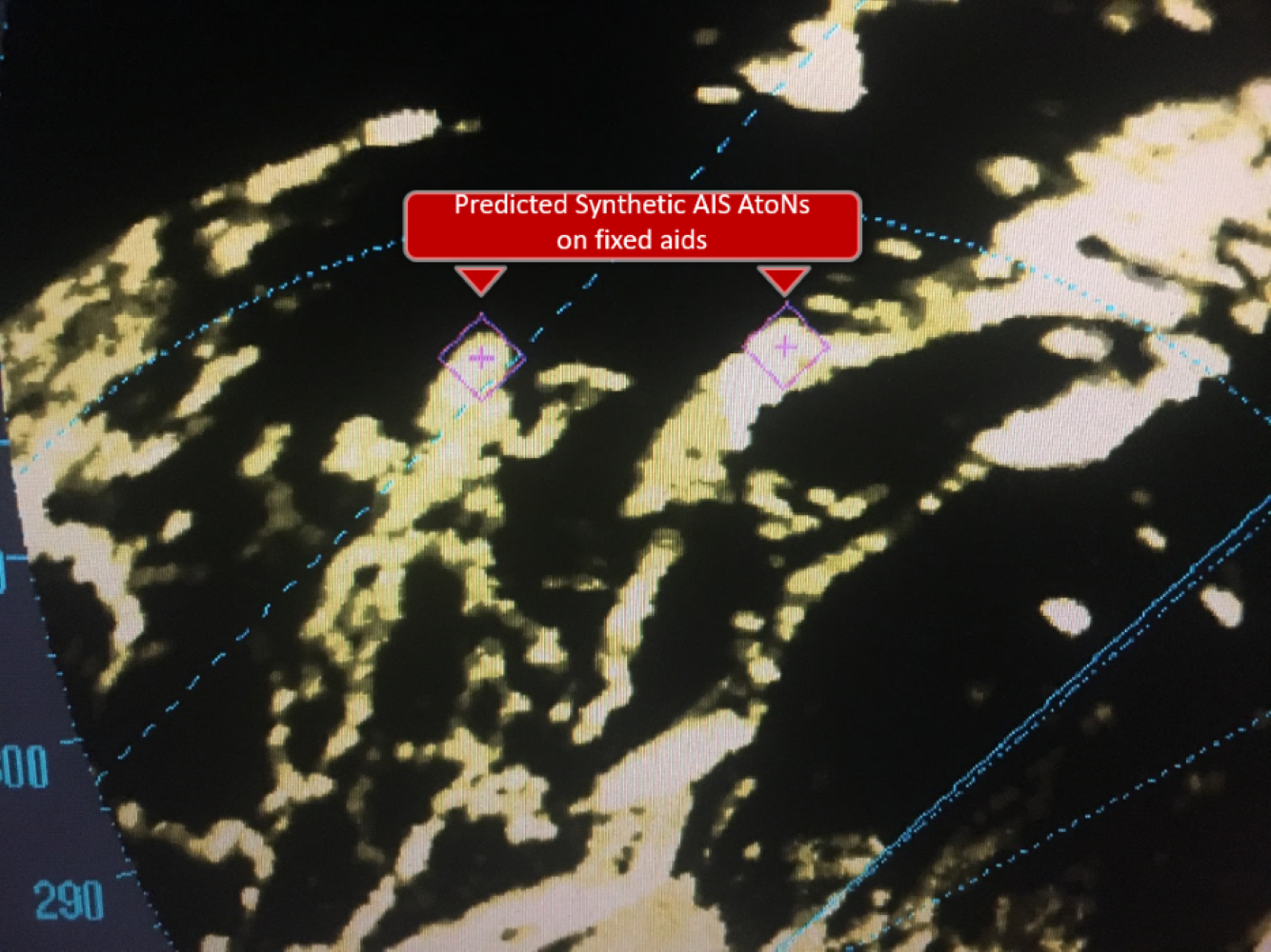
Figure 5-14 illustrates again the range tracking enhancement on the radar using AIS AtoN symbols.
Section 5.2.3. Protecting Whales - Identification of Dynamic Sectors
Virtual AIS AtoN are used in the Gulf of St. Lawrence as a complementary measure to limit the risk of collisions between transiting vessels and North Atlantic right whales. Virtual AIS AtoN are positioned at all four corners of each dynamic speed reduction zones. Virtual AIS AtoN are broadcast only when the speed reduction is in effect in one or more zones. By clicking one of the symbols, a message is displayed indicating the zone and the speed limit (see Figure 5-16).

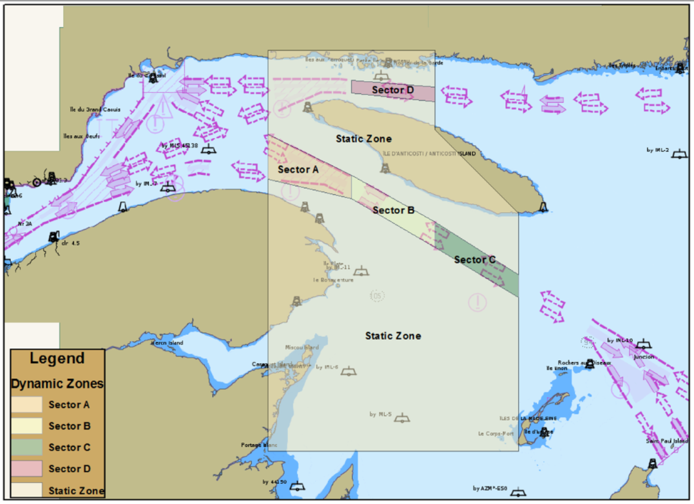
This application enables rapid interaction with mariners and informs them of the status of the zone through which they are transiting.
Section 5.3. Conclusion
Various test beds were used to validate the reliability of AIS AtoN signals. AIS AtoN also facilitates the detection of potential errors on shipboard equipment by comparing the displayed information between the systems (PPU, ECDIS, and radar). Another benefit is that AIS AtoN makes it easier to locate aid radar echoes in all weather and traffic conditions.
Report a problem on this page
- Date modified:
