Section 4. How AIS AtoN Work
Section 4.1. Physical AIS AtoN
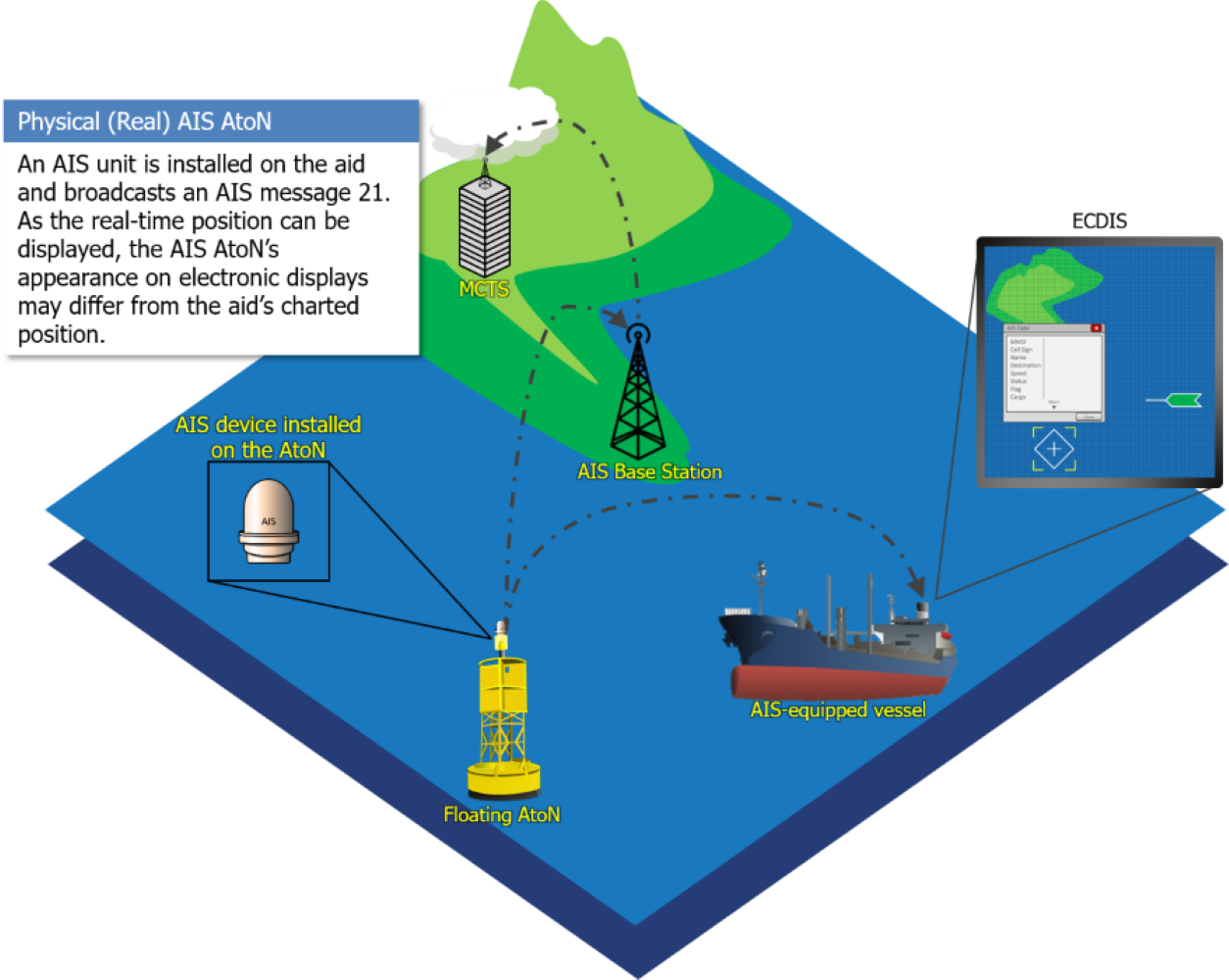
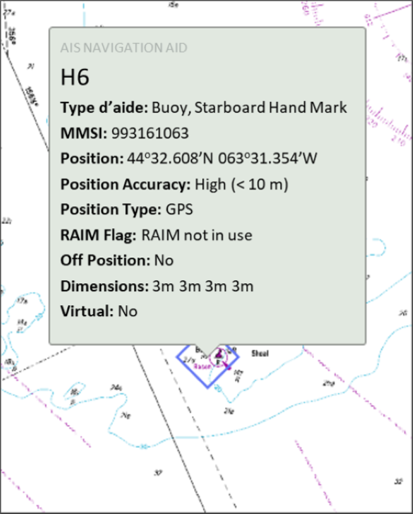
An AIS unit is installed on a fixed or floating aid to navigation (AtoN) and directly broadcasts its own AIS Message 21. The AIS Message 21 may include such information as:
- Type and name of the aid;
- Real-time position of the AtoN; and
- AtoN status such as light operation error, RACON, floating aid “Off Position” indicator, etc.
In the case of a floating aid, an “Off Position” indicator signals a warning that the aid is outside its assigned position radius. In addition, a Physical AIS AtoN may also be used to broadcast Virtual and Synthetic AIS AtoN.
Section 4.2. Virtual AIS AtoN
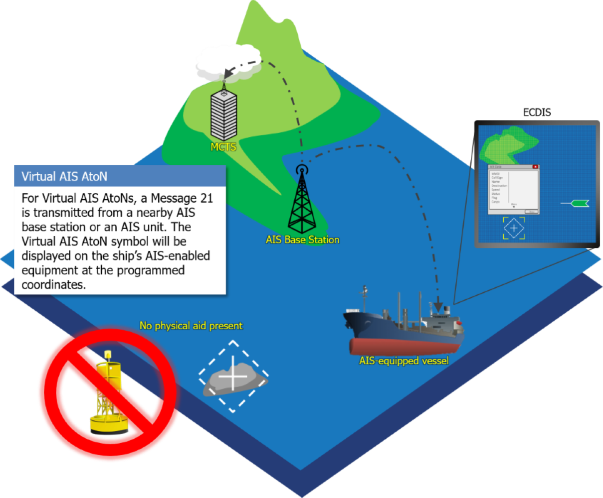
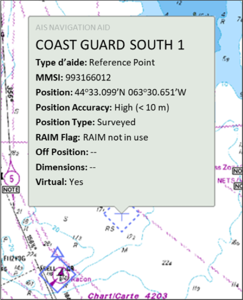
A Virtual AIS AtoN is an AIS Message 21 broadcast from an AIS shore station or an AIS unit installed on another device (e.g., a fixed or floating aid), in situations where there is no physical aid to navigation.
The Virtual AIS AtoN serves to either warn of a danger or to transmit information relevant to mariners.
Section 4.3. Synthetic AIS AtoN
Synthetic AIS AtoN are divided into two categories: Monitored Synthetic and Predicted Synthetic.
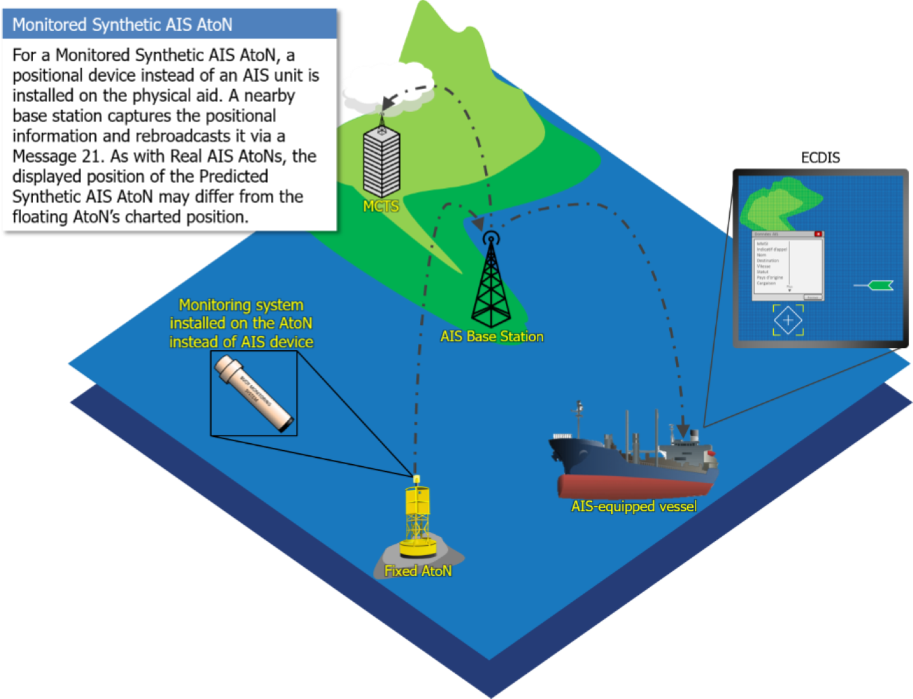
Section 4.3.1. Monitored Synthetic AIS AtoN
Section 4.3.2. Predicted Synthetic AIS AtoN
A Predicted Synthetic AIS AtoN is an AIS Message 21 broadcast from an AIS shore station or an AIS unit installed on another device (e.g., a fixed or floating aid). The AtoN on which the AIS Message 21 is broadcast physically exists, but neither the position nor the status are monitored.
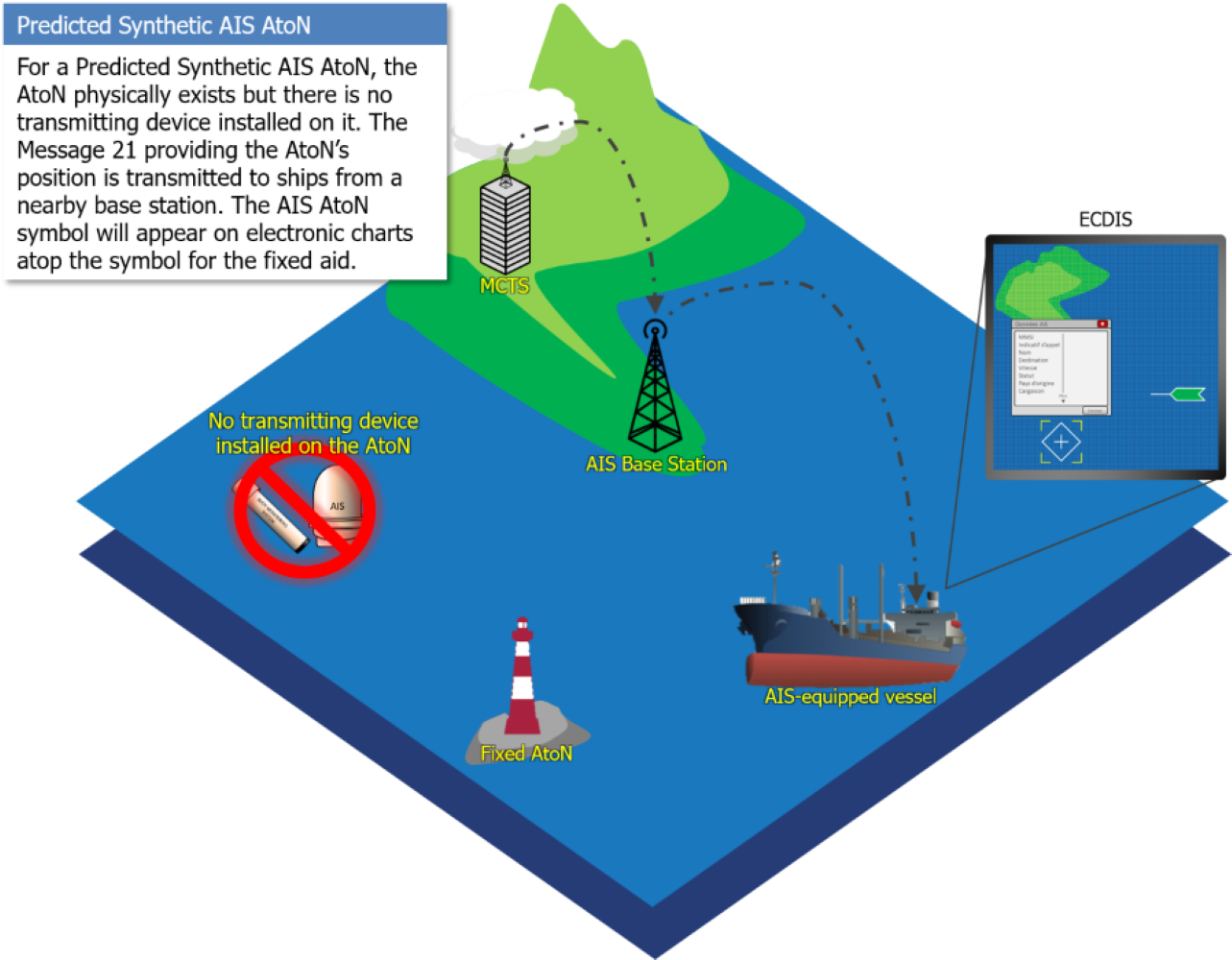
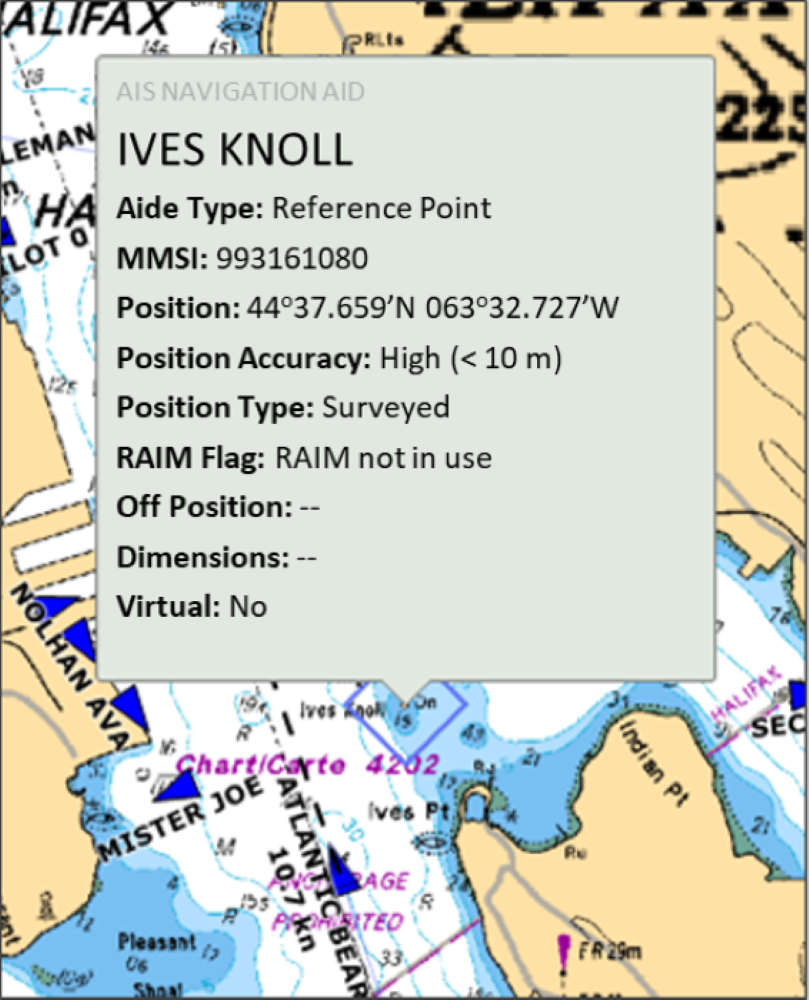
Predicted Synthetic AIS AtoN cannot guarantee the integrity of the AIS Message 21, because the position and status are not monitored. Consequently, and to reduce the risk of confusion, it is not recommended to use it on floating AtoN. The use of a Predicted Synthetic AIS AtoN on a fixed aid is acceptable, as the position will not change, but the status of the AtoN cannot be verified (IALA Guideline 1062).
Section 4.4. AIS signal accuracy - Virtual and Predicted Synthetic AtoN
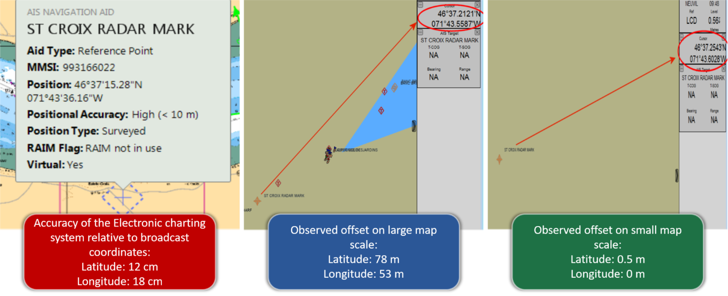
The AIS signal used for Virtual and Predicted Synthetic AtoN is broadcast every three minutes by the Canadian Coast Guard (CCG). Using a surveyed site, the AIS signal has an accuracy of 1/10,000 min in longitude and in latitude, i.e., 18 cm in latitude and 12 cm in longitude (ITU Recommendation M.1371). This high accuracy can be affected by the number of decimals (geographical coordinates) used by the display systems, the scale used, and other factors. Even when considering these elements, it remains that the broadcast regularity and accuracy make it possible to have a good level of confidence in the Virtual and Predicted Synthetic AIS AtoN.
Regarding the scale used on the vessel display systems (ECS, ECDIS, radar), it is important to emphasize that it can affect the accuracy of the geographical coordinates displayed, and a larger scale will give better results. Figure 4-8 shows the differences observed on an electronic chart system according to the scales used. When the cursor is used to obtain the geographical coordinates, it is important to position it on the displayed cross in the centre of the AIS AtoN symbol.
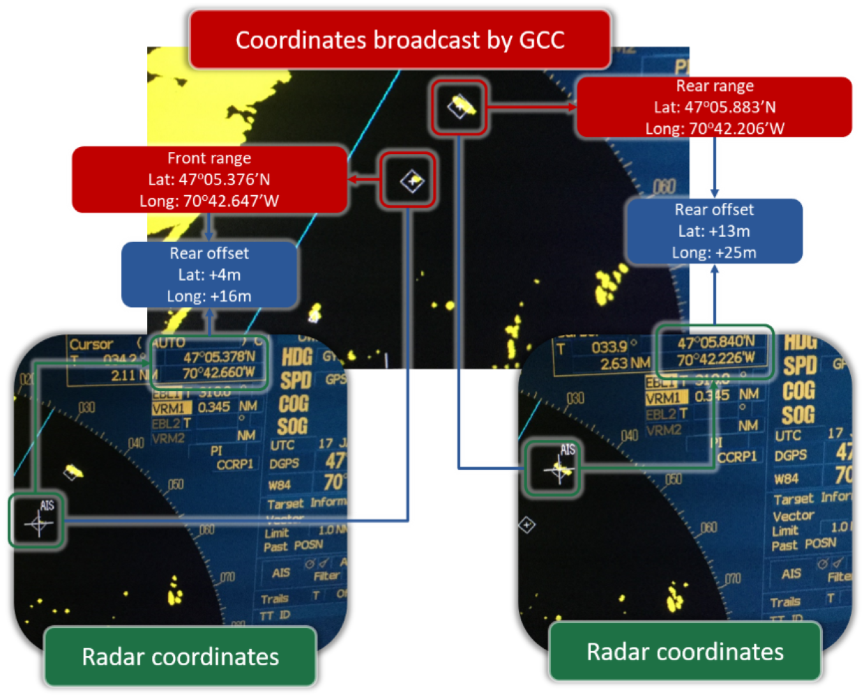
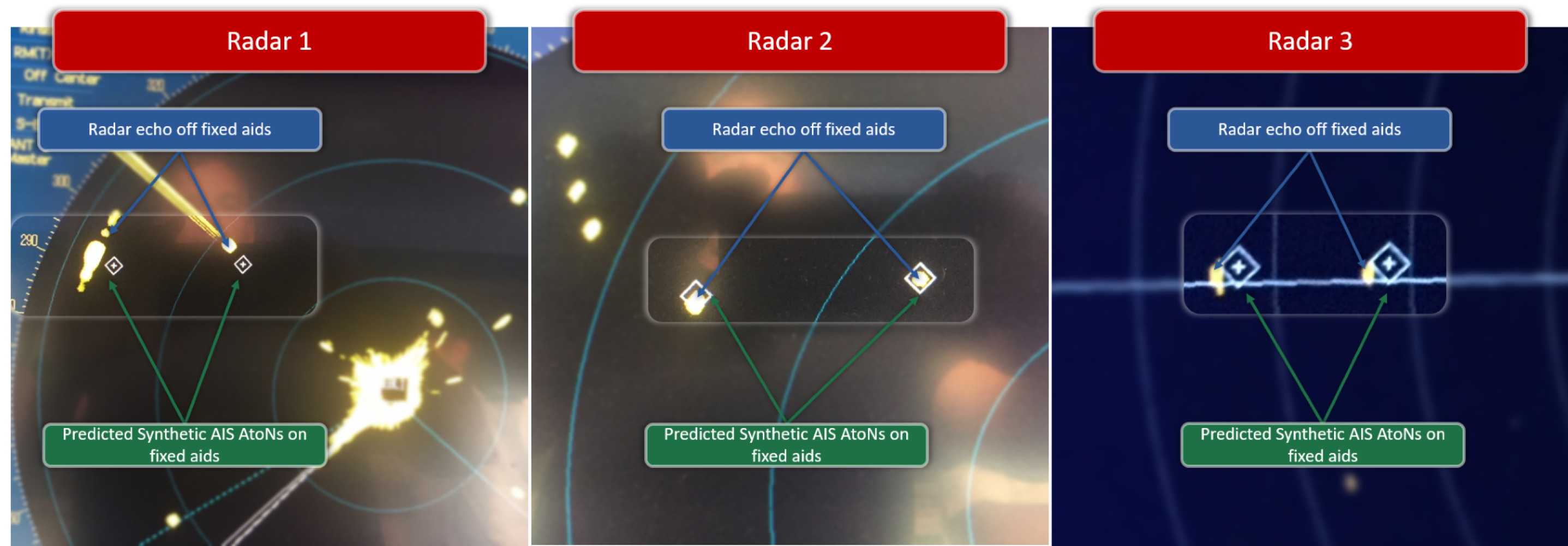
Tests performed with Predicted Synthetic AIS AtoN on fixed AtoN have shown a discrepancy between the radar echoes and the AIS AtoN symbols in certain situations (see Figure 4-10). Additional information is needed to determine the factor(s) that might explain this discrepancy: inherent radar inaccuracies, incorrect GPS and AIS antenna settings, GPS smoothing, etc. These observations led to a proposal to use AIS AtoN as reference points. Additional information on AIS AtoN applications is presented in Section 5.
The information being broadcast can be validated as follows:
- Verify the geographical positions on the PPU or ECDIS by clicking the AIS AtoN symbol and positioning the cursor (TT: Target Tracking) in the centre of the cross in the diamond shape. When the cursor is used to display the geographical coordinates, it is important to bear in mind that the accuracy of the coordinates may be affected by the scale used. A larger scale will give better accuracy. The importance of the selected scale on the accuracy of the displayed information also applies to radar;
- Validate positions with those provided by the Canadian Coast Guard; and
- Compare these geographical positions with those displayed on the radar by placing the cursor at the centre of the AIS AtoN symbol.
If the geographical positions of the AIS AtoN symbols are consistent with those provided by the Canadian Coast Guard, and an offset is still seen with the radar echoes, the reliability of the AIS AtoN symbols may be considered as positive.
This AIS AtoN positioning validation exercise allows users to familiarize themselves with this technology and appreciate its accuracy.
SEE ALSO:
Report a problem on this page
- Date modified:
