Tides, Water Levels and Currents
Water level forecasts and observations, including tide and current tables.
Most requested
National services and information
Canadian Hydrographic Service
Predicted times and heights of high and low waters, and the hourly water levels for over seven hundred stations in Canada.
Tides and Water Levels Historical Data
Station information, digital data inventory of observed water level data available for download.
Water Survey of Canada
Responsible for the collection, interpretation and dissemination of standardized water resource data and information in Canada.
NOAA Water Levels Station Selection (for US Waters)
NOAA's Center for Operational Oceanographic Products and Services (CO-OPS) is the authoritative source for accurate, reliable, and timely tides, water levels, currents and other oceanographic information in the United States.
Regional services and information
Water Level Forecasts and Temperatures
Central regionProduced by the Canadian Coast Guard, give the expected minimum water levels in the central region.
Great Lakes – St. Lawrence River (CHS)
Central regionGreat Lakes’ water movement, water levels and historical data.
Predicted Water Levels & Velocities
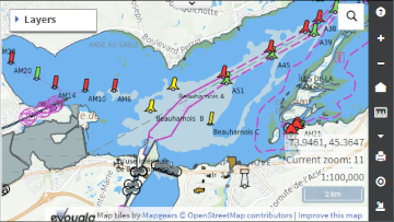
Pacific regionAvadepth, an acronym for available depths, is a Canadian Coast Guard application designed to assist the mariners in determining the maximum draft and the best sailing times on the river.
Features
Report a problem on this page
- Date modified:


